COLUMBIA, S.C. (WIS) – Near normal temperatures and rain likely over the weekend ahead of the coldest weather so far this season next week.
First Alert Headlines
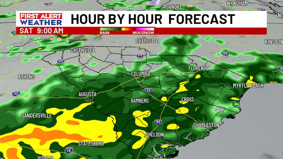
- Scattered showers likely at times today.
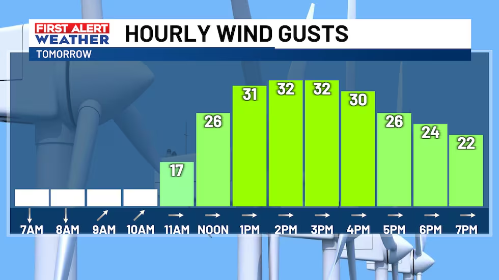
- Winds become gusty Sunday afternoon with frontal passage.
- First Alert Weather Days next week for extreme cold and chance of wintry weather.
First Alert Summary
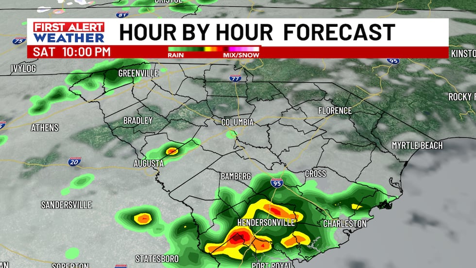
Have your rain gear ready today! Scattered showers are likely today as a front approaches from the west. Rain chances will be highest in the morning before tapering off in the afternoon. Expect high temperatures to reach the middle to upper 50s. Another batch of scattered showers will likely impact parts of the Midlands into tonight as temperatures hold steady in the 40s.
Outsides of a few showers in the morning, rain chances will start to diminish as a whole throughout Sunday. Skies will clear out by the afternoon with highs back in the 50s to near 60-degrees. Winds are also forecast to increase tomorrow with the frontal passage. Expect gusts as high as 30-35 MPH during the afternoon hours. The colder air behind the front will start to funnel in by tomorrow night.
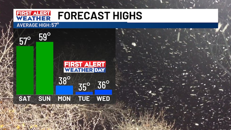
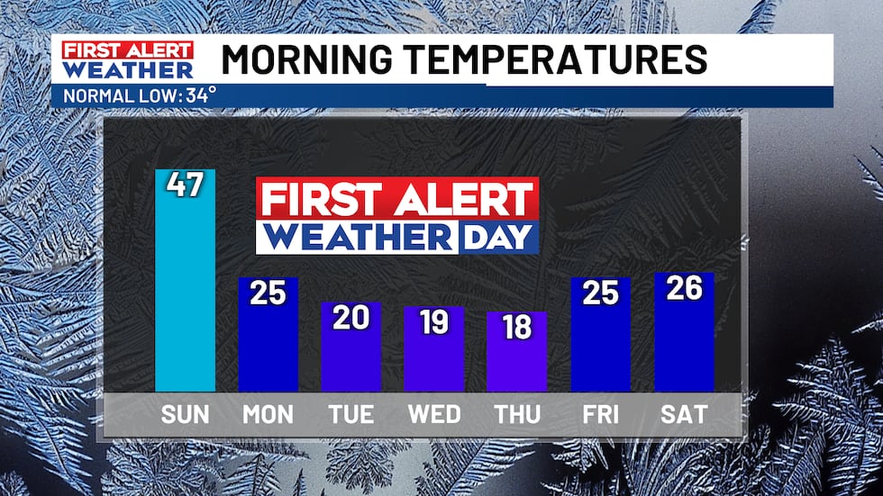
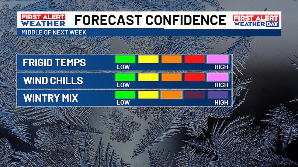
First Alert Weather Days remain in place for the first half of the week ahead for the threat of extreme cold and chance of wintry precipitation. High temperatures for multiple days next week will top out only in the 30s with overnight lows in the teens. With the wind factored in, it could feel much colder at times with winds chills as low as the single digits in some spots.
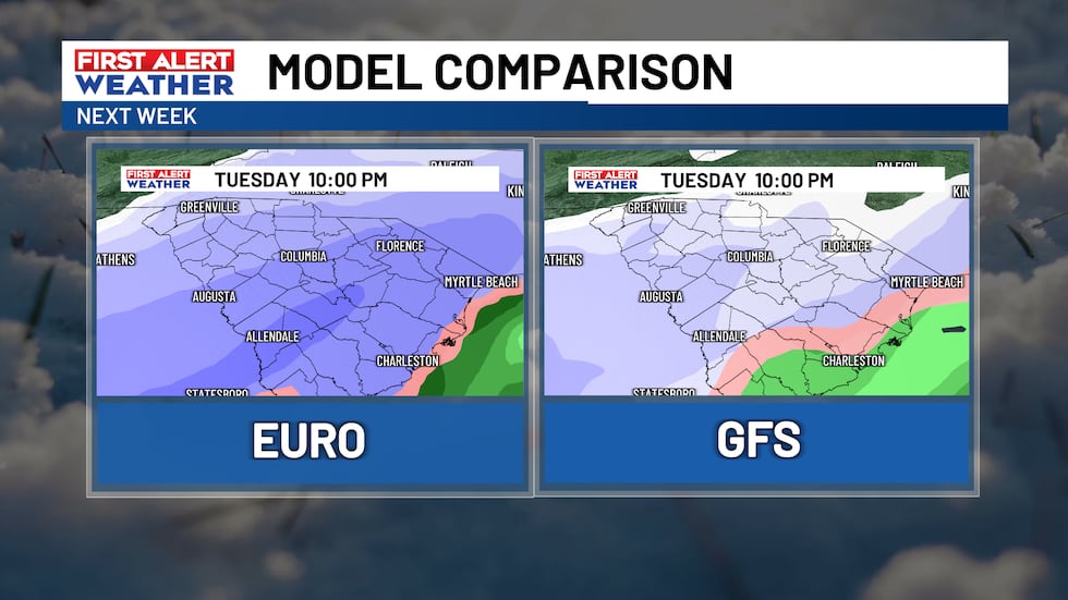
The potential for any wintry weather would exist Tuesday into Tuesday night. Models are coming in a better agreement that the path of this low-pressure system could pass just south of the Midlands. This scenario would give much of the area at least a chance of seeing snow/a wintry mix, especially locations south of I-20. The exact details on accumulation amounts, extent of impacts is still somewhat uncertain. Continue to check back in for more updates as we get closer to time.
First Alert Forecast
Saturday: Rain likely, especially in the morning. Highs top out in the middle to upper 50s.
Tonight: A chance of scattered showers with temperatures in the middle to upper 40s.
Sunday: Few AM showers. Clearing by the afternoon with gusty winds. Highs in the upper 50s.
MLK Day (First Alert Weather Day): Sunny and much colder with highs in the upper 30s.
Tuesday (First Alert Weather Day): Chance of wintry weather/snow. Highs in the middle 30s.
Wednesday (First Alert Weather Day): Frigid day with highs in the middle 30s.
Feel more informed, prepared, and connected with WIS. For more free content like this, subscribe to our email newsletter, and download our apps. Have feedback that can help us improve? Click here.
Copyright 2024 WIS. All rights reserved.
Get ready for a significant weather change as rain moves in today, bringing with it a drastic drop in temperatures for the week ahead. The warm and sunny days we’ve been enjoying will soon be replaced by chilly, wet conditions as a cold front sweeps through the area.
Make sure to grab your umbrella and jacket as you head out today, and be prepared for the colder weather to stick around for the foreseeable future. Stay warm and stay dry as we transition into the next season. Stay tuned for updates on any potential weather advisories or alerts.
Tags:
- Rainy weather forecast
- Cold front approaching
- Weather update: rain and temperature drop
- Weather forecast for the week
- Drastic temperature change ahead
- Rainy day ahead
- Weather alert: cold front incoming
- Winter weather forecast
- Rainy weather predictions
- Weather report: colder days ahead
#Rain #moves #today #Turning #drastically #colder #week #ahead
Leave a Reply
You must be logged in to post a comment.