Your cart is currently empty!
Stray showers followed by a colder, windy start to 2025.
- Few afternoon showers New Year’s Eve
- Turning colder, windy as we enter 2025
- A prolonged stretch of below-average temps.
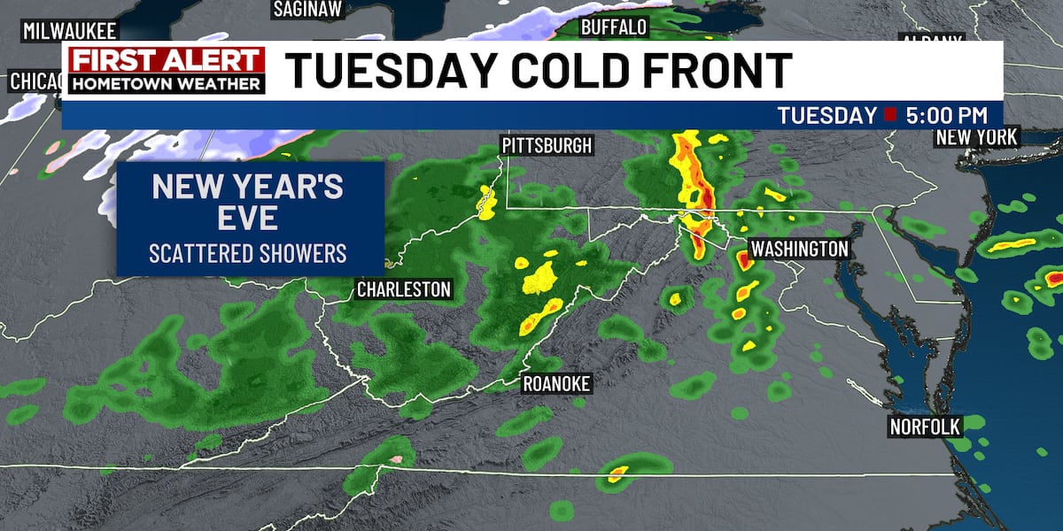
Few Showers Possible Today
A cold front will bring a few showers and even an isolated storm to the region, however, coverage will be spotty and any rain totals will be light.
We’ll shave off a few degrees from the previous day’s temperatures, reaching the low 50s in the mountains, to low 60s across Southside.
Late in the day, the wind kicks in!

Windy Start To 2025
Any precipitation will be ending long before we countdown to 2025. Temperatures around midnight will be in the low 40s, however winds will start increasing as we head into the evening making it feel much colder.
A Wind Advisory is in effect along and west of the Blue Ridge for gusts 30 to 50 mph starting Tuesday evening and lasting through Wednesday evening.

Upslope Mountain Snowfall
The mountains of West Virginia and far Southwest Virginia will experience some snow as the cold air catches up to the precipitation by the evening. Significant snow will last into Wednesday for places like Snowshoe, WV with lighter totals toward Bluefield and Richlands. A few snowflakes could blow over into the New River Valley and Highlands with little accumulation.

NEW YEAR STARTS COLDER
We start the new year with highs in the 30s and 40s and lows in the 20s to near 30°. The forecast looks dry and breezy for the second half of this week. Winds Wednesday will gust 20-30 mph, especially in the higher elevations.

DOWNLOAD the FIRST ALERT WEATHER APP to get the latest weather updates in the palm of your hand.
Bitter Cold Air Almost Certain
This is your First Alert that January is certainly going to be MUCH colder than average. The latest data continues to show several rounds of frigid air moving in during the first 2-3 weeks of the month pushing temperatures 10-20 degrees below normal.
Below are forecasted temperatures for early NEXT week, which show highs in the 30s. It gets even colder by late next week.

The coldest of air may not peak until the middle of the month. Early model guidance is showing the potential for lows in the teens even for the Roanoke Valley by next week, which means rural areas will likely get deep into the single digits.
The coldest temperature we had in 2024 was January 17th when we got down to 13° in the Roanoke Valley. This cold outbreak could surpass that.
Early Signs Of Wintry Weather
The less certain part of the forecast is the opportunity for wintry precipitation. We’re confident in the cold air, but the model trends have been suggesting the opportunity for a low-pressure system (storm) to develop early next week, somewhere around the Jan 6-7 timeframe. Anything more than that is pure speculation at this point.

| CONFIDENCE LEVELS | 1=LOW 10=HIGH |
|---|---|
| Colder Than Average Temperatures | 10 |
| Active Weather Pattern | 5 |
| Winter Storm Development for Our Area | 2 |
Copyright 2024 WDBJ. All rights reserved.
Get ready for a mixed bag of weather as we ring in the new year! Stray showers are expected to pass through the area as we say goodbye to 2024, setting the stage for a colder and windier start to 2025. Don’t let the unpredictable weather dampen your spirits though – grab your coat and scarf and embrace the crisp winter air as we welcome in a fresh start to the new year. Stay safe and stay warm, and here’s to a year full of exciting possibilities ahead! #NewYearWeather #Hello2025 #BundleUp
Tags:
- Stray showers
- Colder start to 2025
- Windy weather forecast
- Weather update 2025
- Winter weather alert
- Cold front approaching
- Windy conditions ahead
- January weather forecast
- 2025 weather outlook
- Meteorological update
#Stray #showers #colder #windy #start

Leave a Reply