Tag: Delays

  • JetBlue hit with $2M fine for chronic flight delays

    JetBlue hit with $2M fine for chronic flight delays


    JetBlue Airways is facing a $2 million fine after a federal government investigation revealed that it was “operating multiple chronically delayed flights.” 

    This marks the first time the U.S. Department of Transportation (DOT) has imposed a penalty on an airline for consistently delaying flights. The government lambasted this action, calling it a “prohibited unrealistic scheduling practice which can harm both passengers and fair competition across the airline industry.” 

    The DOT’s order requires JetBlue to stop chronic flight delays and pay a $2 million penalty, half of which will go directly to the U.S. Treasury. The other half will be used to compensate passengers that were impacted by the chronically delayed flights or any future flight disruptions of three hours or more caused by JetBlue within the next year, the DOT said in its Friday announcement. 

    The future compensation must be valued at a minimum of $75 for each harmed passenger, the DOT said.

    TRAVELING BY PLANE FOR THE HOLIDAYS? HOW AIRLINE REFUND RULES CAN HELP WHEN FLIGHTS ARE CANCELED, DELAYED

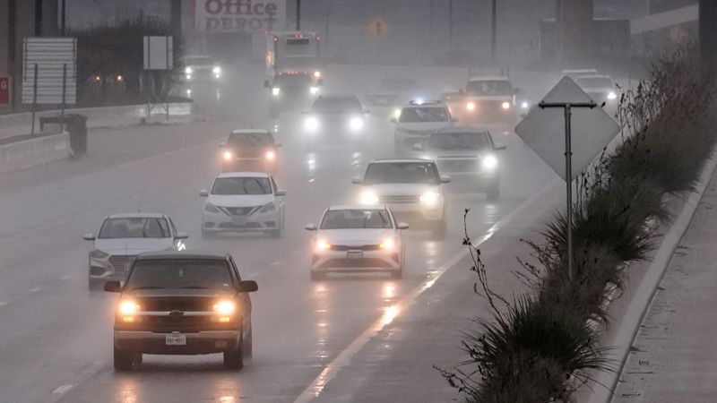
    A JetBlue plane is seen at Fort Lauderdale-Hollywood International Airport in Fort Lauderdale, Florida, on Nov. 1, 2023. (Eva Marie Uzcategui/Bloomberg via Getty Images / Getty Images)

    “Today’s action puts the entire airline industry on notice that we expect their flight schedules to reflect reality,” Transportation Secretary Pete Buttigieg said Friday in a statement. “The department will enforce the law against airlines with chronic delays or other unrealistic scheduling practices in order to protect healthy competition in commercial aviation and ensure passengers are treated fairly.” 

    Under the DOT rules, flights are considered chronically delayed if they are flown at least 10 times a month and arrive more than 30 minutes late, more than half of the time. Cancelations are included as delays within this calculation, the government said. Consistently delaying a flight for more than four consecutive months is considered unrealistic scheduling.

    Following the DOT investigation, government officials discovered that JetBlue operated four chronically delayed flights at least 145 times between June 2022 through November 2023. Each of the four flights was delayed consistently for at least five straight months, according to the DOT. In total, there were 395 delays and cancellations across these four chronically delayed flights in total.

    Additionally, JetBlue continued to operate three more chronically delayed flights between Florida, New York and Connecticut despite receiving warnings from the DOT, officials said. 

    The Bureau of Transportation Statistics estimated that the airline was responsible for over 70% of the disruptions for the four chronically delayed flights based off of data submitted to the DOT by JetBlue.

    Ticker Security Last Change Change %
    JBLU JETBLUE AIRWAYS CORP. 7.48 -0.38 -4.83%

    Under DOT rules, airlines are given “adequate time to fix their schedule after a flight becomes chronically delayed to avoid illegal unrealistic scheduling.” However, the DOT said “JetBlue failed to do so.”

    However, JetBlue told FOX Business in a statement that it has “invested tens of millions of dollars to reduce flight delays, particularly related to ongoing air traffic control challenges” in its largest markets in the Northeast and Florida over the past two years. 

    “Through these efforts, we have seen significant operational improvements in 2024 including better on-time performance during this year’s peak summer travel season,” the New York City-based carrier said. 

    JETBLUE, SPIRIT AGREE TO TERMINATE MERGER OVER REGULATORY ISSUES

    Passengers drop their checked-in bags with JetBlue Airlines at the Fort Lauderdale-Hollywood International Airport in Fort Lauderdale, Florida, on May 16, 2022. (Joe Raedle/Getty Images / Getty Images)

    JetBlue continued by saying that while it reached a settlement to resolve this matter regarding four flights in 2022 and 2023, the carrier believes “accountability for reliable air travel equally lies with the U.S. government, which operates our nation’s air traffic control system.” 

    JetBlue argued that the incoming administration needs to “prioritize modernizing outdated ATC technology” and address “chronic air traffic controller staffing shortages to reduce ATC delays that affect millions of air travelers each year.”

    GET FOX BUSINESS ON THE GO BY CLICKING HERE

    But JetBlue isn’t alone. The DOT stated it is currently investigating other airlines for “unrealistic flight schedules” as well.

    The DOT considers unrealistic scheduling to be deceptive and anticompetitive practice as it denies travelers reliable scheduling information and “allows airlines to unfairly capture business from competitors by misleading consumers.” 


    JetBlue hit with $2M fine for chronic flight delays

    JetBlue Airways has been slapped with a hefty $2 million fine by the Federal Aviation Administration (FAA) for chronic flight delays that have left passengers stranded and frustrated.

    The airline has been under scrutiny for its poor on-time performance, with many flights experiencing significant delays and cancellations. The FAA has determined that JetBlue’s failure to properly manage its flight schedules and adequately address issues such as crew shortages and maintenance problems has led to the repeated disruptions.

    In a statement, the FAA emphasized the importance of ensuring that airlines prioritize the safety and well-being of their passengers by adhering to strict regulations and standards. The $2 million fine serves as a warning to JetBlue and other airlines that the FAA will not tolerate chronic delays that inconvenience travelers and compromise their safety.

    JetBlue has since issued an apology to affected passengers and pledged to improve its operations to prevent future delays. However, the hefty fine serves as a reminder that airlines must prioritize punctuality and reliability to maintain the trust and satisfaction of their customers.

    Tags:

    JetBlue, flight delays, fines, airline penalties, aviation news, travel updates, FAA violations

    #JetBlue #hit #fine #chronic #flight #delays

  • Snow delays start for dozens

    Snow delays start for dozens


    Western Pennsylvania schools closing, delays: Schools start late as snow falls

    ASHLEY IMPACT DAY FOR US. ELENA. THE SNOW IS FLYING AROUND AND IS DROPPING OUR VISIBILITY 1 TO 3IN THREE MILES. EXCUSE ME AROUND A LOT OF THE AREA. YOU CAN SEE THE SNOW COMING DOWN PRETTY GOOD. THIS IS OUR CAMERA ABOVE OUR STATION HERE IN WILKINSBURG. AND THAT LOW VISIBILITY AS THE SNOW IS FALLING DOWNTOWN PITTSBURGH. BUT IT’S NOT JUST ALLEGHENY COUNTY. IT’S ALL THE WAY UP ALONG I-80, DOWN TO INTERSTATE 70. NOW, WHERE YOU ARE SEEING A LITTLE BIT OF A BREAK RIGHT NOW IS IN THOSE HIGHER ELEVATIONS. BUT THIS IS GOING TO CONTINUE TO MOVE EASTWARD. SO FROM PITTSBURGH ON SOUTH WASHINGTON, GREEN, FAYETTE, SOME OF WESTMORELAND, WESTERN PARTS OF WESTMORELAND, SEEING THOSE SNOW SHOWERS A LITTLE BIT MORE STEADY INTO BUTLER, LAWRENCE, BEAVER UP INTO MERCER AND VENANGO COUNTY, WHERE YOU ARE GOING TO SEE AND NORTHERN PARTS OF THE AREA NORTH OF 422. SOME HIGHER AMOUNTS OF ACCUMULATION. WINTER WEATHER ADVISORY IN PLACE UNTIL 10 A.M. SATURDAY MORNING. THIS IS FOR OUR ENTIRE AREA AND A WINTER STORM WARNING. THIS IS INCLUDING THOSE HIGHER ELEVATIONS, EASTERN PORTIONS OF WESTMORELAND, FAYETTE AND INDIANA DOWN INTO GARRETT COUNTY. SO AGAIN, JUST BE AWARE IT’S GOING TO BE A LITTLE TRICKY FOR THE MORNING COMMUTE ON TOP OF IT. IT’S COLD. 21 IS WHAT IT FEELS LIKE IN PITTSBURGH 16 DEGREE WINDCHILL MONROEVILLE AND WASHINGTON 15 IS YOUR REAL FEEL IN GREENSBURG, 18 IN BUTLER AND 12 IN FRANKLIN. AS WE LOOK AT YOUR FOUR DAY FORECAST AGAIN, SNOW SHOWERS FOR US STEADY THROUGH THE MORNING AS WE LOOK OVER THE NEXT 12 HOURS. IT WILL LIGHTEN UP AND GET A BIT MORE SPORADIC IN THE AFTERNOON. BUT SOME LAKE EFFECT SNOW BANDS ARE GOING TO SET UP TONIGHT AND INTO EARLY TOMORROW MORNING. BUT DURING GAME TIME ON SATURDAY IT LOOKS GOOD FOR US. IF YOU’RE TAILGATING, IT’S GOING TO BE COLD AND BRISK. WE’RE GOING TO HAVE TEMPERATURES IN THE MID 20S, BUT OVERALL IT’S GOING TO FEEL LIKE WE’RE IN THE LOW TEENS DURING KICKOFF. IT’S GOING TO FEEL LIKE WE’RE INTO THE SINGLE DIGITS. SO VERY COLD AIR IN PLACE, BUT WE GET SOME SUNSHINE ON SUNDAY AND THEN I’LL BE TRACKING MONDAY. ANOTHER IMPACT DAY DOES HAVE THE POTENTIAL THOUGH. STILL TO UPGRADE TO AN ALERT DAY. BUT OVERALL, AS WE LOOK AT OUR FUTURECAST, WE ARE GOING TO SEE THE SNOW PRETTY STEADY THROUGH THE MORNING, MORE SPORADIC THROUGH THE AFTERNOON AROUND SIX 7:00. TONIGHT IS WHEN THESE SNOW BANDS ARE GOING TO START TO SET UP. THEY’LL BE VERY ISOLATED, BUT WHEN THESE BANDS HIT YOUR AREA, WE’VE SEEN IT. IT DROPS YOUR VISIBILITY AND ADDS AN ADDITIONAL COATING 1 TO 2IN. AND THAT COULD HIT PARTS OF BUTLER, WESTMORELAND, SOMERSET, EVEN INTO WASHINGTON AND GREENE OVERNIGHT INTO EARLY SATURDAY. THIS IS AROUND 8 A.M. THAT WILL START TO PUSH ON OUT, AND THAT’S WHEN THE WINTER WEATHER ADVISORY WILL EXPIRE. THEN WE’LL HAVE THAT GLOOMY CLOUD COVER LINGERING. SO HERE’S HOW MUCH SNOW WE’RE LOOKING AT THROUGH THE DAY TODAY. THIS IS EXTENDING INTO TONIGHT AS WELL. 1 TO 3IN AROUND A LOT OF THE AREA. 2 TO 4 NORTH UP ALONG I-80. THIS IS INCLUDING I DO THINK EVEN NORTH OF 422 3 TO 6 IN THE LAURELS. AND THOSE HIGHER ELEVATIONS WHERE YOU DO HAVE THAT WINTER STORM WARNING. SO YOUR 4-DAY PLUS 4 MORE FORECAST ONCE WE GET THROUGH TODAY. KEEPING AN EYE ON MONDAY. IT’S A VERY TRICKY FORECAST NOW. RIGHT NOW IT LOOKS LIKE TO BE MAINLY A SNOW EVENT. WE COULD HAVE A COUPLE INCHES, BUT DOES HAVE THE POTENTIAL TO PUSH A LITTLE FURTHER SOUTH, GIVING US MORE SNOW THROUGH THE AREA OR PUSHING A LITTLE FURTHER NORTH WHERE WE COULD HAVE SOME FREEZING RAIN MIXING IN. SO WE WILL BE MAKING THAT ALERT DAY DECISION HERE AS WE GET INTO THE AFTERNOON, AS WE FINE TUNE SOME OF THOSE WEATHER MODELS. BUT OVERALL WE ARE GOING TO BE WATCHING MONDAY RIGHT NOW. IMPACT

    Western Pennsylvania schools closing, delays: Schools start late as snow falls

    Dozens of schools are starting late this morning as snow causes tricky travel for the morning commute. Visit this link to view the closings, delays list and refresh that page often for updates. We’re tracking the full forecast and what it could mean for your area.The entire Pittsburgh area is under a Winter Weather Advisory. The advisory is in effect until 10 a.m. on Saturday.A Winter Storm Warning is in effect for the highest elevations of Westmoreland, Fayette and Indiana Counties through the day Friday. The warning will expire at 10 a.m. on SaturdayMore: Weather alerts for your countyInteractive radar: Track the stormLearn how to enable automatic weather alerts on the WTAE mobile app Snow will impact your morning commute but will taper off and be more scattered through the afternoon. Lake effect snow bands are expected to set up this afternoon and could drop visibility to parts of the area and add an additional coating to an inch of snow on the ground but will be very isolated

    Dozens of schools are starting late this morning as snow causes tricky travel for the morning commute.

    Visit this link to view the closings, delays list and refresh that page often for updates.

    We’re tracking the full forecast and what it could mean for your area.

    The entire Pittsburgh area is under a Winter Weather Advisory. The advisory is in effect until 10 a.m. on Saturday.

    A Winter Storm Warning is in effect for the highest elevations of Westmoreland, Fayette and Indiana Counties through the day Friday. The warning will expire at 10 a.m. on Saturday

    Snow will impact your morning commute but will taper off and be more scattered through the afternoon. Lake effect snow bands are expected to set up this afternoon and could drop visibility to parts of the area and add an additional coating to an inch of snow on the ground but will be very isolated


    Winter weather has once again wreaked havoc on our schedules, as dozens of schools and businesses are experiencing delays due to heavy snowfall. The picturesque scenes of snow-covered landscapes may be beautiful to look at, but they are causing headaches for commuters and students alike.

    While some may be enjoying a cozy snow day at home, others are scrambling to rearrange their plans and figure out how to navigate the slippery roads. The snow delays are a reminder of the unpredictable nature of winter weather and the need to always be prepared for unexpected disruptions.

    As we wait for the snow to be cleared and the roads to be safe for travel, let’s take this opportunity to appreciate the beauty of winter and the importance of staying safe and cautious during these challenging times. Stay warm, stay safe, and stay tuned for updates on when things will get back to normal.

    Tags:

    • Snow delays
    • Winter weather delays
    • Snowstorm impacts
    • Weather delays
    • Snowfall disruptions
    • Travel delays
    • Snowstorm effects
    • Snowstorm aftermath
    • Winter weather challenges
    • Snowstorm setbacks

    #Snow #delays #start #dozens

  • Closings and delays for central Iowa schools and businesses

    Closings and delays for central Iowa schools and businesses


    Iowa weather: Closings and delays for central Iowa schools and businesses

    TOWARD THE METRO, RIGHT IN TIME FOR RUSH HOUR. AND SO IT IS IT LOOKS LIKE IT’S FLYING HORIZONTALLY. SO WE YOU SAY IT’S A THICK BAND MARCHING THIS WAY. AND THAT’S WHAT IS GOING TO IMPACT VISIBILITY. EXACTLY. YEAH. EVEN THE LIGHTER STUFF STILL GOING TO IMPACT IT, BUT NOT AS MUCH AS WHAT I’VE BEEN TALKING ABOUT. AS FAR AS THE THICKER BAND OUT TO THE WEST RIGHT NOW, OUR SKY CAMS SHOWING PRINCIPAL PARK CAMERA NOT REALLY ANY FLAKES GOING ON INSIDE THE DOWNTOWN AREA, HOWEVER. SEVEN OAKS, THAT’S WHERE WE’RE DEFINITELY SEEING MORE OF THAT ACTIVITY. SOME ACTUAL SNOW. YOU DON’T NEED THE SNOW MAKERS IN THE SEVEN OAKS AND BOONE COUNTY THIS MORNING. AS THE SNOW CONTINUES TO MAKE ITS WAY OVER THE STATE RIGHT NOW, HYPER FOCUSED ON THE METRO IN DES MOINES DOWNTOWN, NOT REALLY SEEING THAT THAT’S GOING TO BE EVEN PERIODS OVER ALTOONA GOING TOWARDS PLEASANT HILL, SEEING SOME OF THE LIGHT FLAKES ALREADY, SOME PARTIALLY COVERED ROADS BEING REPORTED THIS DIRECTION, BUT REALLY FARTHER NORTH, LIKE OVER ANKENY TOWARDS AMES AS WELL. BUT THE THICKER BAND OF SNOW, THAT DARKER SHADE OF BLUE THAT’S GOING TO REDUCE VISIBILITIES UNDERNEATH A MILE, POTENTIALLY EVEN SOME WHITEOUT CONDITIONS EMBEDDED IN THAT BAND IS WHAT WE CAN EXPECT, AS THAT HEAVIER SNOW MAKES ITS WAY CLOSER, NOT TOO FAR AWAY. IT’S JUST NOW ENTERING GUTHRIE COUNTY, GOING INTO GREENE COUNTY AND ALSO ADAIR COUNTY CURRENTLY. SO IT IS KNOCKING ON OUR DOOR AS WE GO THROUGH THE REST OF THIS MORNING, HOUR BY HOUR, TRACKING THAT BAND AND ALSO THE LIGHT SNOW TO MODERATE SNOW AHEAD OF IT THROUGHOUT THE MORNING. IT’S GOING TO CONTINUE TO MAKE ITS WAY EAST, KEEPING ITS STRUCTURE. IT’S NOT GOING TO WIND DOWN. THIS IS NOT A WEAKENING SYSTEM. IT’S GOING TO STAY PRETTY CONSISTENT THROUGHOUT THE REST OF THE MORNING. THAT BAND TOUCHING THE I-35 CORRIDOR CLOSER AROUND THE 8 TO 9:00 HOUR OR SO ALONG I-35. TRAVEL IS GOING TO BE RATHER TREACHEROUS. NOT JUST SLICK ROADS, BUT AGAIN, THOSE EXTREME LOWERED VISIBILITIES WITH THIS AS IT CONTINUES TO MAKE ITS WAY FARTHER EAST, WE’RE STILL GOING TO BE LOOKING AT SNOW OVER POLK COUNTY, OVER THE METRO BY 10 A.M., BUT IT DOES START TO WIND DOWN BY AROUND THE LUNCHTIME HOUR. AND MAINLY THE SNOW IS NOW ALL EAST OF I-35. CATCHING A BREAK AND EVEN COULD EVEN CLEAR THINGS UP FOR THE REST OF THE AFTERNOON AFTER THE SNOW PUSHES OUT. BY 5:00 ON OUR RIDE HOME. NOT DEALING WITH ANY MORE OF THAT SNOW, BUT THIS IS WHAT’S GOING TO LEAVE IN ITS WAKE. AROUND 2 TO 4IN FOR CENTRAL IOWA. ALONG THAT I-80 CORRIDOR AND SOME AREAS OF THE SOUTHEAST AND NORTHWEST OF THERE. SO WE’RE SEEING THE MOST IMPRESSIVE TOTALS WITH THIS, BUT THEN NORTH AND SOUTH OF THAT, YOU MAY CLOSE AROUND A TRACE TO TWO INCHES OF SNOW FOR, AGAIN, NORTHERN IOWA AND SOUTHERN IOWA. THEN FOR THE REST OF FRIDAY, WE’RE PRETTY MUCH DONE. WE’RE GOING TO BE LOOKING AT PARTLY CLOUDY SKIES, SOME CLOUD COVER HOLDING ON TO THE SOUTHWESTERN PORTION OF THE STATE. THIS IS ALL AHEAD OF THE NEXT SYSTEM MOVING IN FOR THE WEEKEND. THAT WILL BE SATURDAY NIGHT. WE’RE TALKING AFTER MIDNIGHT AND THEN GOING ALL THE WAY INTO SUNDAY. THE BULK OF THIS SYSTEM, THE MAIN FOCUS OF THIS NEXT WEEKEND SYSTEM, WILL BE SOUTH OF IOWA, BUT IT IS EXPECTED TO CLIP THE SOUTHERN COUNTIES LIKELY SNOW ACCUMULATIONS FARTHER SOUTH OF I-80. POSSIBLE AND CENTRAL IOWA UNLIKELY. THE FARTHER NORTH YOU GO. SO ALONG HIGHWAY 20 AND NORTH OF THERE. NOT GOING TO SEE A GREAT CHANCE OF SNOW THIS UPCOMING WEEKEND. THIS IS A SYSTEM THAT STILL CAN CHANGE ITS TRAJECTORY, ITS PATH. SO I’M GOING TO KEEP AN EYE ON THIS AS WE GO THROUGH THE REST OF THIS WEEK. I’M REALLY GOING TO BETTER INFORMATION, MORE ACCURATE INFORMATION GOING THROUGH THE REST OF TODAY, GOING INTO TOMORROW, AS FAR AS WHAT TO EXPECT FOR SUNDAY MORNING. SNOW WRAPS UP AS WE GET IN THE AFTERNOON. HIGHS RIGHT NEAR 30 DEGREES, NOT BREAKING THE FREEZING POINT SO THAT SNOW IS GOING TO STICK EASILY. IT WILL STAY WITH US AS WE GO INTO THE WEEKEND EVEN. BUT THEN SATURDAY NIGHT INTO SUNDAY, COLDER TEMPERATURES, ANOTHER ROUND OF SNOW POSSIBLE, AND THEN WE’LL BE LOOKING AT SOME COLDER TEMPERATURES EVEN MORE AS WE GO INTO NEXT WEEK. HI

    Iowa weather: Closings and delays for central Iowa schools and businesses

    While most Iowa students are not back in classrooms yet, a handful of school districts have already announced closings and delays. Multiple central Iowa districts, including Carroll, Madrid, North Polk and more, have announced closures or 2-hour delays Thursday due to severe weather. Beautiful Beginnings Childcare in Polk County is closed Thursday.Additionally, all DMACC locations will open at 10 a.m. Thursday. You can see a full list of closings and delays here. Interactive Radar | Weather Alerts» Download the free KCCI app to get updates on the go: Apple | Google PlayGet the latest headlines from KCCI

    While most Iowa students are not back in classrooms yet, a handful of school districts have already announced closings and delays.

    Multiple central Iowa districts, including Carroll, Madrid, North Polk and more, have announced closures or 2-hour delays Thursday due to severe weather. Beautiful Beginnings Childcare in Polk County is closed Thursday.

    Additionally, all DMACC locations will open at 10 a.m. Thursday.

    You can see a full list of closings and delays here.

    Interactive Radar | Weather Alerts

    » Download the free KCCI app to get updates on the go: Apple | Google Play

    Get the latest headlines from KCCI


    Attention Central Iowa residents: Here is a list of schools and businesses that are closed or delayed due to inclement weather:

    School Closings:
    – Des Moines Public Schools
    – Ankeny Community Schools
    – Urbandale Community Schools
    – West Des Moines Community Schools
    – Johnston Community Schools
    – Ames Community Schools

    School Delays:
    – Waukee Community Schools: 2-hour delay
    – Indianola Community Schools: 2-hour delay
    – Newton Community Schools: 2-hour delay
    – Marshalltown Community Schools: 2-hour delay

    Business Closings:
    – Wells Fargo branches in Des Moines metro area
    – Principal Financial Group offices in downtown Des Moines
    – MercyOne Medical Center in West Des Moines
    – UnityPoint Health clinics in Polk County

    Please stay safe and check back for updates on closures and delays in your area.

    Tags:

    1. Closings and delays in central Iowa
    2. Central Iowa school and business closures
    3. Central Iowa weather-related closures
    4. Iowa school and business delays
    5. Central Iowa snow day updates
    6. Severe weather closures in central Iowa
    7. Central Iowa winter storm delays
    8. School and business closings in central Iowa
    9. Iowa school delays due to weather
    10. Central Iowa emergency closures and delays

    #Closings #delays #central #Iowa #schools #businesses

  • Travelers experiencing delays due to I-85 shutdown

    Travelers experiencing delays due to I-85 shutdown


    Travelers and commuters may be experiencing delays on Thursday evening due to a shutdown on Interstate 85.The South Carolina Department of Transportation reports an incident at Exit 44 to Whitehorse Road on I-85.It appears the interstate is shutdown in both directions between Exit 42 (I-185) and Exit 46 (Augusta Road) in Greenville County.South Carolina Highway Patrol said “I-85 Northbound and Southbound in Greenville County is closed near Mile Marker 44 due to an active incident. Both sides of the interstate are closed until further notice. Road detours are posted, but the public is urged to avoid I-85 in this area until further notice. Additional details will be provided as more information is confirmed.”SCDOT originally reported the incident as a hazardous materials spill, but is now calling it a crash.Details are very limited at this time as authorities have not provided any additional details regarding the incident.For detours:Troopers said Northbound traffic will exit Interstate 85 @ 40 mm. Turn left turn onto SC 153. Travel SC 153 (Brown Road) to SC 20 (Piedmont Hwy). At SC 20 (Piedmont Hwy) turn left and travel SC 20 to Bracken Road. Turn Left on Bracken Rd and travel Bracken Road to US 25 ( August Rd). Turn left at US 25 (August Road) and travel north to SC 291. Travel SC 291 back to Interstate 85 North. The traffic will enter Interstate 85 @ 46MMDetour from Interstate 85 South:Interstate 85 Southbound traffic will exit Interstate 85 @ 46 MM ( SC 291). Traffic will turn left on SC 291 traveling south. Traffic will travel south to US 25 ( August Road). Traffic will travel south on US 25 (August Road) to Bracken Road. Traffic will turn right onto Bracken Road and travel Bracken Road to SC 20 ( Piedmont Hwy). Traffic will turn right onto SC 20 and travel to Brown Road (SC 153). Traffic will turn left on Brown Road ( SC 153) and travel SC 153 back to Interstate 85 at the 40 MM.

    Travelers and commuters may be experiencing delays on Thursday evening due to a shutdown on Interstate 85.

    The South Carolina Department of Transportation reports an incident at Exit 44 to Whitehorse Road on I-85.

    i-85 shutdown

    It appears the interstate is shutdown in both directions between Exit 42 (I-185) and Exit 46 (Augusta Road) in Greenville County.

    South Carolina Highway Patrol said “I-85 Northbound and Southbound in Greenville County is closed near Mile Marker 44 due to an active incident. Both sides of the interstate are closed until further notice. Road detours are posted, but the public is urged to avoid I-85 in this area until further notice. Additional details will be provided as more information is confirmed.”

    SCDOT originally reported the incident as a hazardous materials spill, but is now calling it a crash.

    Details are very limited at this time as authorities have not provided any additional details regarding the incident.

    For detours:

    Troopers said Northbound traffic will exit Interstate 85 @ 40 mm. Turn left turn onto SC 153. Travel SC 153 (Brown Road) to SC 20 (Piedmont Hwy). At SC 20 (Piedmont Hwy) turn left and travel SC 20 to Bracken Road. Turn Left on Bracken Rd and travel Bracken Road to US 25 ( August Rd). Turn left at US 25 (August Road) and travel north to SC 291. Travel SC 291 back to Interstate 85 North. The traffic will enter Interstate 85 @ 46MM

    Detour from Interstate 85 South:

    Interstate 85 Southbound traffic will exit Interstate 85 @ 46 MM ( SC 291). Traffic will turn left on SC 291 traveling south. Traffic will travel south to US 25 ( August Road). Traffic will travel south on US 25 (August Road) to Bracken Road. Traffic will turn right onto Bracken Road and travel Bracken Road to SC 20 ( Piedmont Hwy). Traffic will turn right onto SC 20 and travel to Brown Road (SC 153). Traffic will turn left on Brown Road ( SC 153) and travel SC 153 back to Interstate 85 at the 40 MM.


    Travelers experiencing delays due to I-85 shutdown

    Attention all travelers! Due to the unexpected shutdown of Interstate 85, many commuters and travelers are experiencing significant delays and disruptions to their travel plans. The closure of this major highway has caused a ripple effect throughout the surrounding areas, leading to increased traffic congestion and longer commute times.

    Whether you are a daily commuter, a visitor passing through the area, or a truck driver transporting goods, it is important to plan ahead and allow for extra travel time. Alternate routes and detours are in place, but they may also be congested and slow-moving.

    We advise all travelers to stay informed about the latest updates on the I-85 shutdown and to adjust their travel plans accordingly. Your safety and well-being are our top priorities, so please exercise caution and patience while navigating through the affected areas.

    We apologize for any inconvenience this may cause and appreciate your understanding during this challenging time. Stay safe and stay informed as you navigate through the delays caused by the I-85 shutdown.

    Tags:

    1. I-85 shutdown travel delays
    2. Atlanta traffic updates
    3. Travel disruptions I-85 closure
    4. Travel tips during highway closure
    5. I-85 bridge collapse travel delays
    6. Interstate 85 shutdown updates
    7. Navigating travel delays I-85 closure
    8. Alternative routes I-85 shutdown
    9. Atlanta traffic congestion I-85 closure
    10. Travel advice for I-85 shutdown delays.

    #Travelers #experiencing #delays #due #I85 #shutdown

  • Vt. Corrections delays release of notorious repeat offender Harley Breer

    Vt. Corrections delays release of notorious repeat offender Harley Breer


    MONTPELIER, Vt. (WCAX) – The expected release of one of Vermont’s most notorious career criminals has prompted concerns in the community where he plans to live, but Vermont Corrections officials say Harley Breer’s release has now been delayed.

    Breer has been in and out of jail since the late 1980s for a variety of crimes, including kidnapping, sexual assault, and assault. He has been in prison since his arrest following a five-day manhunt in April 2021. His minimum release date was Dec. 1, 2024, and Vermont’s Department of Corrections confirmed to WCAX News the state is preparing Breer for release. The news was first reported by freelance journalist Mike Donoghue. But Wednesday morning, a DOC spokesperson told WCAX News that they are now delaying Breer’s release until at least next week. We don’t know why.

    Word of Breer’s release sent shockwaves through the small town of Canaan. “We got a close community here and I don’t think we need to be releasing a habitual offender like that into this community,” said Jeffery Juskewicz, a local resident.

    Breer has been behind bars since his most recent arrest after a manhunt in 2021, serving the minimum amount of a four-to-10-year sentence. He passed his minimum release date at the beginning of December and while delayed, the DOC has been preparing to release him on furlough.

    “Eventually, after he serves his time, he’s going to have to be released, but hopefully not released into this small community that barely has any police presence,” said Blanca d’Anjou of Canaan.

    Essex County State’s Attorney Vince Illuzzi also questions the decision to release Breer to live in the community. “The rural Northeast Kingdom, the town of Canaan, is not an appropriate placement for someone with Mr. Breer’s history,” he said.

    Illuzzi expressed frustration with the DOC for not notifying local law enforcement of their plan first. A notice from DOC did go out to law enforcement agencies in central Vermont, where Breer is from. Sources tell WCAX News that the notice states Breer is considered at high risk to re-offend.

    Illuzzi says his remote county is ill-equipped to keep track of an offender like Breer. “When you have a rural area with no major law enforcement presence. and a department of corrections office that will supervise him almost an hour away, that spells trouble on the line,” he said.

    Canaan is covered part-time by the Essex County Sheriff’s Department and U.S. Border Patrol. If Breer is released, Illuzzi says he communicated to DOC Commissioner Nick Deml that it be in a location with an adequate police presence.

    And local residents echoed those hopes. “Peoples in jail — they ought to stay in jail, not loose to public peoples and do more harm. Eventually, they’re going to do it again,” said Canaan resident Marc Marchessault.

    HARLEY BREER’S LIST OF CRIMES IS LONG

    Harley Breer’s first brush with the law dates back to the ‘80s.

    His first rape charge came in 1990. Dozens of felony charges would follow, including kidnappings. In one of his most notorious, a brutal kidnapping case in Barre in 1999, Breer abducted his ex-girlfriend’s mother, tied her up, and was accused of sexually assaulting her before abandoning the woman at a remote hunting camp. That crime put him away for eight years. But he did not leave prison rehabilitated.

    Breer was arrested again in In 2011 for beating and raping another girlfriend and stealing her truck. He was captured in New Hampshire.

    While awaiting trial, he was arrested again for contacting his victims.

    Breer’s multiple charges were rolled into a plea deal in 2017. He received credit for the five years he served and his 20 to 45 year sentence was suspended. He was placed on probation for 45 years and claimed to be a “changed man.” “Some of it’s maturity, some of it’s — I’ve grown up. But today, I find myself looking at different things, like how I became a grandfather in the last five years. So, I’ve got a different set of priorities,” Breer said at the time.

    But one year later he was back in custody again accused of kidnapping and assault. This time, he received more serious charges of being a “habitual offender.” He pleaded no contest and got probation again.

    And just about a year later, in 2021, Breer triggered a manhunt after cutting off his ankle bracelet and escaping house arrest. It would be another month before authorities would find Breer and arrest him. The then 53-year-old took another plea deal and was sentenced to four to ten years in prison and 20 years of probation.

    And last month, with credit for time served, Breer reached his minimum release date.


    The Vermont Department of Corrections is facing criticism after announcing that the release of notorious repeat offender Harley Breer has been delayed. Breer, who has a long history of violent crimes, was set to be released on parole but will now remain behind bars for an indeterminate amount of time.

    The decision to delay Breer’s release comes after concerns were raised about the potential danger he poses to the community. Breer has a rap sheet that includes multiple assaults, robberies, and even a manslaughter charge. Many fear that he will reoffend if released back into society.

    The Vermont Department of Corrections has not provided a specific reason for the delay in Breer’s release, but officials have stated that they are taking the necessary precautions to ensure public safety. However, critics argue that the delay is a sign of the department’s failure to properly manage dangerous offenders like Breer.

    As the debate over Breer’s release continues, the Vermont Department of Corrections is under increasing pressure to address the issue of repeat offenders and improve the system for managing high-risk individuals. The case of Harley Breer serves as a stark reminder of the challenges that the department faces in balancing public safety with the rights of prisoners.

    Tags:

    1. Vermont Corrections
    2. Harley Breer
    3. Repeat offender
    4. Release delay
    5. Notorious criminal
    6. Vermont Department of Corrections
    7. Criminal justice system
    8. Prison release delay
    9. Harley Breer case
    10. Criminal recidivism

    #Corrections #delays #release #notorious #repeat #offender #Harley #Breer

  • Judge delays removal of Eritreans that deceived Canadian authorities

    Judge delays removal of Eritreans that deceived Canadian authorities


    The family came to court without ‘clean hands’ because the adult applicants deceived immigration authorities about their Swedish citizenship for many years

    Article content

    An Eritrean family granted refugee status in Canada without telling immigration authorities they already had Swedish citizenship has convinced a Federal Court judge in Ottawa to delay their removal from Canada so the children can continue their schooling here, even though their parents came to court “without ‘clean hands’” due to their deception.

    Solomon Yohannes Goitom, Eden Rezene and their two children were scheduled to be sent back to Sweden on Dec. 28 because although they had been granted refugee status in Canada, it later came to light that they actually had obtained Swedish citizenship.

    Advertisement 2

    Article content

    However, the family had applied to the court to defer their removal so their kids can continue studying in Canada.

    “I am satisfied based on the particular circumstances of this case, taking into account the evidence provided by the eldest child, who will be graduating from middle school this year, and the evidence about the school year calendar in Sweden, that irreparable harm has been established because of the short-term best interests of the children,” Justice Lobat Sadrehashemi said in a Dec. 23 decision allowing the family to stay in Canada, at least temporarily.

    Lawyers for Immigration, Refugees and Citizenship Canada argued that the family came to court “without ‘clean hands’ because the adult applicants deceived immigration authorities about their Swedish citizenship for many years.”

    The family had asked that the Canada Border Services Agency “defer their removal until the children finish the school year,” but that was denied by the agency on Dec. 18.

    They came to Canada in 2016 “and made refugee claims alleging persecution in Eritrea,” said the decision granting them a reprieve.

    Article content

    Advertisement 3

    Article content

    They didn’t disclose the fact that they had Swedish citizenship and were granted refugee status.

    “Later, (the immigration minister) learned that the applicants had Swedish citizenship and brought an application to vacate their refugee status before the Refugee Protection Division,” said the decision, which notes the family lost both their refugee and permanent resident status in Canada in 2022.

    Recommended from Editorial

    The couple had a third child here, “who is impacted by my decision because this child will leave Canada with his parents and siblings if the stay is denied,” Sadrehashemi said. The judge did not make any note of the third child’s citizenship, though babies born in Canada are almost always automatically Canadian citizens at birth.

    Sometime after they lost their refugee status in Canada, the family applied for permanent residence “based on humanitarian and compassionate grounds” as well as a pre-removal risk assessment — a last-ditch bid to stay in Canada. “Both these applications were refused,” Sadrehashemi said.

    Advertisement 4

    Article content

    The family got their travel documents on Nov. 8, and 12 days later the CBSA told them to report for removal on Dec. 28.

    The family had been working with CBSA to arrange travel documents for Sweden, but “there is a dispute between the parties about the applicants’ level of cooperation with their removal,” said the judge.

    She exercised her discretion and provided the relief the family was seeking.

    “There is no evidence that there has been misconduct related to CBSA’s efforts at removal (of the family) that are the subject of this stay motion. Further, the serious issue and irreparable harm being raised in this motion relate to the short-term best interests of the children, who had no part in the misconduct raised by the Minister. In these circumstances, I find the balance of convenience favours granting the motion and staying the applicants’ removal from Canada.”

    The family’s reprieve could be short-lived.

    Sadrehashemi’s stay will last until the family gets a final decision on their separate application for a judicial review of the “decision to refuse the deferral of their removal.”

    Our website is the place for the latest breaking news, exclusive scoops, longreads and provocative commentary. Please bookmark nationalpost.com and sign up for our daily newsletter, Posted, here.

    Article content


    In a recent court ruling, a judge has decided to delay the removal of a group of Eritreans who deceived Canadian authorities about their identities. The individuals in question had falsely claimed to be from a different country in order to gain entry into Canada.

    The judge’s decision to delay their removal comes after their lawyers argued that they would face persecution if returned to Eritrea, their country of origin. The lawyers also raised concerns about the lack of due process in the removal proceedings.

    This case highlights the complexities and challenges of immigration and refugee law, particularly when individuals provide false information to authorities. It raises important questions about how to balance the need for security and integrity in immigration processes with the duty to protect those who genuinely fear persecution.

    The judge’s decision to delay the removal of these individuals underscores the importance of a fair and thorough assessment of each case before making such significant decisions. It also serves as a reminder of the need for transparency and accountability in immigration procedures to ensure that justice is served for all involved parties.

    Tags:

    1. Eritreans in Canada
    2. Deception in Canadian immigration
    3. Legal delay for Eritrean removal
    4. Immigration fraud case in Canada
    5. Eritrean asylum seekers in legal trouble
    6. Judge ruling on Eritrean deportation
    7. Eritreans facing removal in Canada
    8. Immigration deception case update
    9. Canadian authorities and Eritrean immigrants
    10. Legal battle for Eritrean refugees in Canada

    #Judge #delays #removal #Eritreans #deceived #Canadian #authorities

  • More holiday travel delays expected as powerful thunderstorms intensify from Texas to Alabama

    More holiday travel delays expected as powerful thunderstorms intensify from Texas to Alabama


    CNN
     — 

    Holiday travelers returning home this weekend could contend with more delays at airports as severe thunderstorms intensify in the South and a parade of atmospheric river-fueled storms slams the West.

    More flight delays and cancellations could be on the horizon this busy holiday weekend after over 18,000 flights into, out of, or within the United States were delayed or canceled Thursday and Friday, according to FlightAware.com. As of Saturday afternoon, more than 590 flights have already been canceled into or out of the US.

    After severe storms brought tornadoes, damaging winds and large hail to parts of Texas, Louisiana, Mississippi and Alabama Thursday and Friday, the threat of severe weather is expected to ramp up again across the South Saturday from Texas to Alabama.

    “An outbreak of severe storms with tornadoes, wind damage, and large hail is expected from parts of the Southern Plains, into the Lower Mississippi Valley and central Gulf Coast states,” the National Weather Service said. “Several long track tornadoes are expected.”

    The strongest tornadoes could come late Saturday afternoon into the evening, the weather service said. The Storm Prediction Center has increased the tornado risk to a level 4 of 5 moderate risk of severe weather across parts of central Louisiana, Mississippi, and western Alabama.

    A tornado watch has been issued for parts of eastern Texas until 5 p.m. CST. This watch includes Waco and College Station, extending the area of the previous watch, which covers Lake Charles, Baton Rouge, and Shreveport, Louisiana, and Jackson and Hattiesburg, Mississippi.

    An additional 2 million people live in this tornado watch, bringing the total number of Americans currently in a tornado watch to nearly 7 million.

    Supercell storms continue to be capable of producing a couple tornadoes, golf ball-size hail and 70 mph damaging winds.

    “Thunderstorms will intensify rapidly through the afternoon, with a few severe storms expected. Large hail and damaging winds are the main concerns, but a few tornadoes are also possible later today as winds aloft strengthen,” says the Storm Prediction Center.

    The threat shifts Sunday to the Southeast and the East Coast – where tornado-spawning storms are possible in Georgia, the Carolinas and Virginia. Rain from this storm could lead to some minor travel delays in the East Coast.

    Meanwhile in the West, a continued series of atmospheric river-fueled storms is delivering more rounds of dangerous waves, powerful winds, heavy rainfall and thick mountain snowfall across the Pacific Northwest and Rockies this weekend. An additional 4 to 6 inches or more rain and 1 to 2 feet of mountain snow is likely.

    People are seen at a crosswalk on California and Mason street during heavy rain in San Francisco, California, on Thursday.

    A multi-day severe storm threat will continue to impact the South Saturday, likely bringing travel headaches to those attempting to return home on the final weekend of the year.

    “Large hail, damaging winds, and tornadoes are likely, potentially including a few strong (EF2+) tornadoes,” warns the Storm Prediction Center. “At least some damaging wind/tornado threat will probably continue through late Saturday night/early Sunday, including parts of Alabama/Florida Panhandle, and potentially northward into the Cumberland plateau vicinity.”

    Tornadoes are much less common in the US during the month of December, averaging only around 40 – compared to the nearly 270 seen on average in May.

    This year, however, has continued to be well above average. As of December 27, there have been 1,783 tornado reports – well above the average of 1,347 reports.

    From eastern Texas to western Georgia, cities like Houston, Memphis, Nashville, Atlanta, New Orleans and Birmingham could see an isolated chance of tornadoes as well as damaging wind gusts and large hail.

    A severe thunderstorm watch is already in effect for parts of eastern Texas including Dallas, southeastern Oklahoma and southwestern Arkansas. These supercells will be capable of golf ball-size hail and 60 mph damaging winds.

    “The threat area will shift eastward from parts of north and central Texas early, across east Texas and the lower Mississippi Valley today, then over the Tennessee Valley, parts of Georgia, and the central Gulf Coast tonight,” says the Storm Prediction Center.

    As daytime heat and humidity fuels more storms, these supercells could be capable of several tornadoes, some of which could be strong and violent. By the late evening and overnight, these storms will form into a line of severe storms capable of widespread wind damage and embedded tornadoes.

    On Sunday, the severe storm threat weakens as it spreads to the Southeast, the East Coast and parts of the Mid-Atlantic. The area includes the cities of Atlanta, Georgia, and Charlotte and Raleigh, North Carolina.

    A lower severe storm threat spreads from the Florida Panhandle to southwestern Pennsylvania. Cities that could see some damaging wind gusts and a chance of tornadoes include Atlanta, Jacksonville, Pittsburgh and Virginia Beach.

    Travelers trying to return home and those with layovers in the Pacific Northwest might need to allot extra time for travel and monitor later legs in their journey home on the final weekend of 2024 as atmospheric river-fueled storms bring more unsettled weather.

    “The revolving door of mid-latitude cyclones propagating through the Pacific Northwest is likely to continue through the rest of the weekend,” the National Weather Service said.

    The storms are expected to lash California’s coast with massive waves.

    The latest storm of the series is expected to move onshore Saturday, bringing dangerously high waves and powerful rip currents across the West Coast – making for dangerous conditions for swimmers.

    The worst coastal conditions are expected across the Pacific Northwest Coastlines and across the Bay Area, where waves up to 30 feet are possible over the weekend. High waves up to 15 feet could be seen as far south as the Malibu coast and across Los Angeles, San Luis Obispo, Santa Barbara and Ventura counties.

    “Dangerous swimming and surfing conditions and localized beach erosion can be expected. Large waves can sweep across the beach without warning, pulling people into the sea from rocks, jetties and beaches. Sudden immersion in cold water can result in cold water shock even for the most experienced swimmers,” the weather service warns.

    High winds are expected to continue to blow across parts of the Pacific Northwest and the Rockies, where high wind alerts are in place. Winds gusting over 75 mph are possible, which could topple trees and power lines.

    “Widespread power outages are expected,” warns the weather service. “Travel will be difficult, especially for high profile vehicles, including areas along Highway 395 and Highway 95 near Walker Lake.”

    Winter weather alerts are in place across parts of the Cascades, Sierra Nevada and Rockies as rounds of moisture continue to impact the West. Snowfall of 6 to 18 inches and gusts potentially over 70 mph could reduce visibility and make travel nearly impossible.

    Along with the snowfall, avalanche warnings have been issued for the mountains of northern Utah, including the Wasatch Range and Bear River Range. “Very dangerous avalanche conditions are expected to develop on many slopes,” warns the Utah Avalanche Center.

    Heavy rainfall is expected along the coastal portions of the Pacific Northwest and across the lower elevations of the Cascades. An additional 4 inches of rainfall is possible through the weekend, which could bring storm totals to nearly 10 inches.


    With the holiday season in full swing, many travelers are facing delays and disruptions as powerful thunderstorms intensify from Texas to Alabama. The National Weather Service has issued severe weather warnings for several states, including Texas, Louisiana, Mississippi, and Alabama.

    These thunderstorms are expected to bring heavy rain, strong winds, and possible tornadoes, which could lead to flight cancellations, road closures, and other travel disruptions. Travelers are advised to check their flight status and road conditions before heading to the airport or hitting the road.

    If you’re planning to travel during this time, it’s important to stay informed and prepared for potential delays. Consider booking a flexible ticket or travel insurance to protect yourself in case of cancellations or delays. And remember to pack essential items like a phone charger, snacks, and water in case you get stuck at the airport or on the road.

    Stay safe and stay informed as you navigate through these holiday travel delays. And remember, patience is key when dealing with Mother Nature’s unpredictable weather patterns. Safe travels!

    Tags:

    1. Holiday travel delays
    2. Thunderstorms intensify
    3. Texas to Alabama
    4. Severe weather alert
    5. Travel disruptions
    6. Weather updates
    7. Flight cancellations
    8. Road trip safety
    9. Stormy holiday travel
    10. Travel advisory

    #holiday #travel #delays #expected #powerful #thunderstorms #intensify #Texas #Alabama

  • Collins confirms Allegris seat delays

    Collins confirms Allegris seat delays


    Eventually the Allegris cabin should fly on Lufthansa’s 787s. But it won’t be anytime soon.

    Multiple reports earlier this week tied delivery delays of Lufthansa‘s new 787 aircraft to certification challenges with the new Allegris business class seats for that aircraft. Collins Aerospace, the manufacturer of those seats, has now confirmed that issue.

    In a statement issued to PaxEx.Aero a company spokesperson shared, “Collins continues to work closely with its OEM partners, customers and regulators in support of the ongoing certification and delivery process.” That the certification and delivery process is “ongoing” leaves the timeline for resolution frustratingly open-ended.


    First announced in 2017, and expected to fly on the 777X in 2020, the Allegris program has been beset by delays ever since.

    Boeing‘s certification issues came first, followed by COVID-19, and supplier manufacturer delays like this one. The program has been behind schedule basically since the day it was announced.

    Of note, Collins is also the manufacturer of the First Class Suites for Allegris. That product was sufficiently delayed that the carrier ultimately flew its initial Allegris-configured A350s without the cabin installed so it could get the planes into service.


    By March 2025 Lufthansa expects to have three A350s fully fitted, enough to guarantee the configuration on three routes. And to charge for the different Allegris seating types as a result.


    These seats are incredibly complex. Each iteration brings new and interesting design and build challenges to the fore.

    A full sheet of plywood with many wires, cables, buttons, lights, and controllers mounted on it. They eventually all get installed in the seat.
    The wire mess that is the control cabling for an Allegris First Class suite (image via Collins Aerospace)

    Crash-test certification rules remain strict, and ever more complicated as the variations in cabin layout play out.

    Or, as one industry professional lamented, “This is truly bafflingly bad for everyone.”


    A favor to ask while you’re here…

    Did you enjoy the content? Or learn something useful? Or generally just think this is the type of story you’d like to see more of? Consider supporting the site through a donation (any amount helps). It helps keep me independent and avoiding the credit card schlock.


    Collins, a leading manufacturer of aircraft seats, has confirmed that delays in the production of seats for Allegris, the luxury airline, have been caused by unforeseen issues in the manufacturing process.

    In a statement released today, Collins apologized for the delays and assured customers that they are working diligently to rectify the situation.

    “We understand the frustration that our customers may be feeling due to the delays in receiving their Allegris seats,” said a spokesperson for Collins. “We want to assure everyone that we are doing everything in our power to expedite the production process and get these seats delivered as soon as possible.”

    Collins has been a trusted supplier of aircraft seats for many years and is known for their high-quality products. However, this recent delay has caused concern among Allegris passengers who were looking forward to experiencing the luxury and comfort of the new seats.

    “We are deeply sorry for any inconvenience this delay may have caused and we are committed to making it right for our customers,” the spokesperson added.

    Collins has promised to provide regular updates on the status of the seat production and delivery process and has offered compensation to affected passengers.

    “We appreciate the patience and understanding of our customers during this time and we are working tirelessly to resolve the issue,” the spokesperson concluded.

    Passengers who have been affected by the delays are encouraged to contact Collins directly for more information and assistance.

    Tags:

    1. Collins
    2. Allegris
    3. Seat delays
    4. Collins news
    5. Allegris updates
    6. Seat delays confirmation
    7. Latest Collins news
    8. Allegris seat delay announcement
    9. Collins confirms delay
    10. SEO specialist insights

    #Collins #confirms #Allegris #seat #delays

  • Weather at Supersport Park Stadium delays start for day 3 of Pakistan vs South Africa Centurion Test

    Weather at Supersport Park Stadium delays start for day 3 of Pakistan vs South Africa Centurion Test


    The first Test of the two-match series between Pakistan and South Africa in Centurion faces uncertainty due to adverse weather conditions.

    Scheduled to resume today, play has been delayed by overnight rain, leaving the ground wet but not unplayable. Live action is expected to commence shortly.  

    According to AccuWeather, the forecast remains concerning, with a 90% probability of precipitation and a 54% chance of thunderstorms later in the day.

    The cloudy skies, coupled with wind gusts reaching up to 28 km/h, are likely to make conditions challenging for both teams. The anticipated rainfall of 2.9 mm could disrupt proceedings, with precipitation expected for up to two hours.  

    Despite the weather concerns, the morning session holds immense significance for both sides.

    Pakistan, trailing by two runs, will resume their second innings with Babar Azam and Saud Shakeel at the crease and Mohammad Rizwan yet to bat. The task is on the middle order to set a challenging target for the hosts. 

    The pitch conditions, still offering bounce, swing, and turn, promise to keep the bowlers in the game.

    For South Africa, quick wickets in the first session could cement their upper hand in the match.  

    The weather, however, remains a major factor. The day is expected to remain mostly cloudy, with occasional showers and thunderstorms potentially interrupting play


    The weather at Supersport Park Stadium in Centurion has caused a delay in the start of day 3 of the Pakistan vs South Africa Test match. The overcast conditions and intermittent rain have made it impossible for play to begin on time.

    Both teams are eagerly waiting to resume the action, with Pakistan looking to build on their strong position from day 2 and South Africa hoping to make a comeback. The ground staff is working hard to prepare the field for play, but the weather forecast suggests that there may be further delays throughout the day.

    Fans are advised to stay tuned for updates on when the match will start and to keep an eye on the weather conditions. Hopefully, the sun will come out soon and we can witness some exciting cricket between these two competitive teams. Stay tuned for more updates on the Pakistan vs South Africa Test match at Supersport Park Stadium.

    Tags:

    • Supersport Park Stadium
    • Weather delays
    • Pakistan vs South Africa
    • Centurion Test
    • Cricket match
    • Day 3
    • South Africa cricket
    • Pakistan cricket
    • Test match
    • Sports news

    #Weather #Supersport #Park #Stadium #delays #start #day #Pakistan #South #Africa #Centurion #Test

  • Delays recurrent neural network theory and application of state estimation(Chinese Edition)

    Delays recurrent neural network theory and application of state estimation(Chinese Edition)


    Price: $41.80
    (as of Dec 24,2024 21:28:58 UTC – Details)


    Publisher ‏ : ‎ Science Press (October 8, 2014)
    Language ‏ : ‎ Chinese
    ISBN-10 ‏ : ‎ 7030418913
    ISBN-13 ‏ : ‎ 978-7030418913


    Delays Recurrent Neural Network Theory and Application of State Estimation (Chinese Edition)

    In this post, we will dive into the fascinating world of delays recurrent neural networks and their applications in state estimation. Delays recurrent neural networks are a type of neural network that can capture temporal dependencies in data by incorporating delays in the connections between neurons. This allows them to model dynamic systems with memory, making them particularly useful for tasks such as time series prediction and control.

    We will explore the theoretical foundations of delays recurrent neural networks, including their architecture, training algorithms, and properties. We will also discuss their practical applications in state estimation, where they can be used to estimate the current state of a system based on past observations.

    So if you’re interested in learning more about delays recurrent neural networks and their applications in state estimation, stay tuned for our upcoming posts!
    #Delays #recurrent #neural #network #theory #application #state #estimationChinese #Edition

Chat Icon