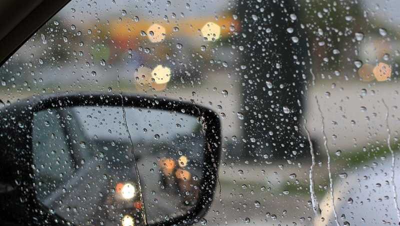
Austinites prepared Monday for expected icy conditions Tuesday with temperatures predicted to drop to frigid levels.
Travis, Williamson, Hays and Bastrop counties, along with much of the area east of the Interstate 35 corridor, will be under a winter storm warning through 6 p.m. Tuesday, while western Hill Country counties are under a winter storm advisory through that time, according to the National Weather Service.
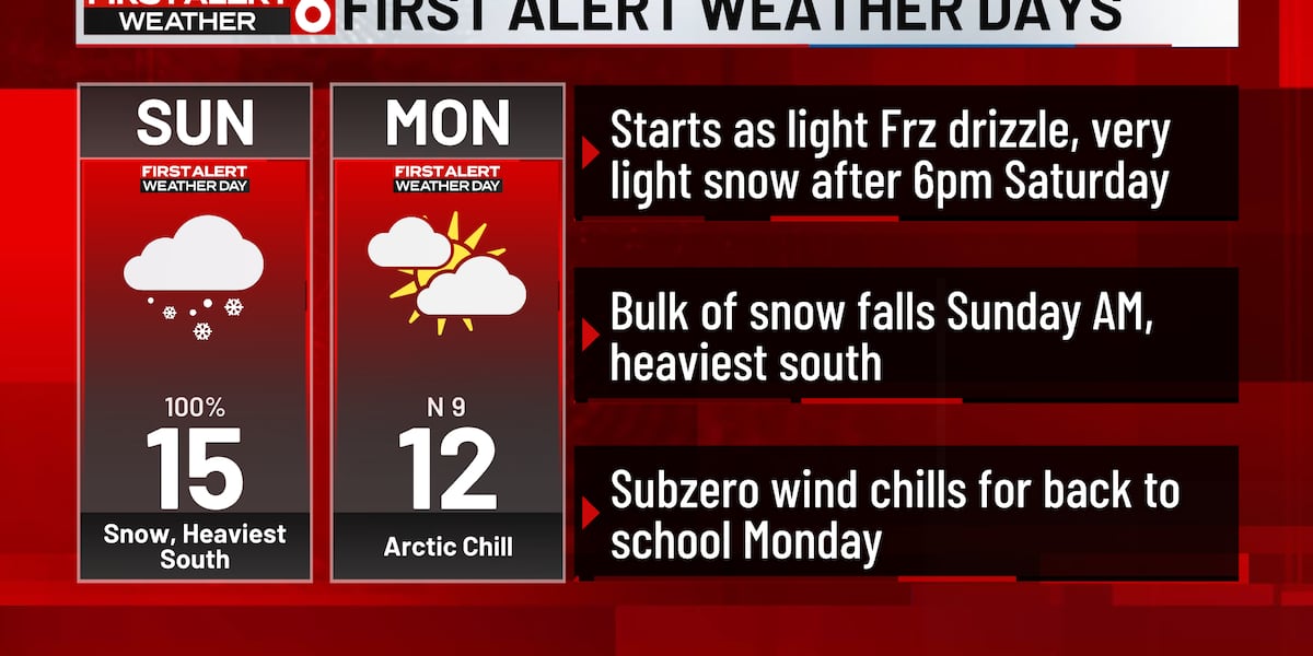
Meteorologists expect less than 1 inch of snow accumulation throughout much of the region Tuesday morning, though some areas east of Austin could see up to 2 inches. Areas south of Austin could have up to one-tenth of an inch of ice accumulation.
In preparation for the freezing rain, all Central Texas school districts — including the Austin district — and the University of Texas, Austin Community College and Texas State University announced they would be closed Tuesday. Huston-Tillotson University moved classes online.

There’s a good chance of snow when people wake up Tuesday morning, and ice is likely, said Eric Platt, a meteorologist with the National Weather Service in New Braunfels.
“Be prepared for there to be slippery or slick road conditions,” Platt said.
If it warms up enough during the day Tuesday, it’s possible for some of that accumulated snow and ice to melt, but snow or ice that sticks around Tuesday will refreeze Wednesday night, when temperatures are expected to plunge into the 20s or teens, Platt said.
“Some of those outlying areas will probably get down to around 17 degrees,” Platt said.
To prepare for the precipitation, the Texas Department of Transportation treated roads in advance, according to the office.
People who need a warm place Tuesday can visit the central branch of the Austin Public Library, 710 W. Cesar Chavez St., starting at 8 a.m. Other library branches will open on a normal schedule.

Austinites ready for the cold
On the quiet Martin Luther King Jr. holiday Monday, Austinites braced against the cold.
On Riverside Drive, Sylvester Anselmo loaded groceries into his car. He wasn’t very concerned about the cold temperatures since they’re supposed to last only a couple of days — not like the week of subfreezing weather in 2021, when millions of Texans lost power for days.
“It’s not going to be that bad,” Anselmo said.
He was a little worried about the precipitation since he works overnight as a custodian and has to drive from Cedar Creek to Lakeway, he said.
Outside of his home in the Travis Heights neighborhood, Gail Armstrong prepared for the cold by replacing the propane in the trailer in front of his house. He is using the heat from the trailer to keep his water heater warm in the subfreezing temperatures.
He was thankful Monday hadn’t brought precipitation on a morning that was cold enough to freeze his birdbath. He’s worried about Tuesday’s forecast.

“People don’t know diddly about driving on snow and ice,” Armstrong said.
Armstrong was also loading his truck with diapers for his and wife Ellen Johnson’s weekly volunteer shift at the Bread for All food pantry.
“I don’t expect a big crowd,” Armstrong said. “It’s cold.”
Travis County offices to close Tuesday; city to continue essential services
All Travis County offices and “certain services and facilities that are non-essential” will be closed Tuesday, Travis County Judge Andy Brown said Monday morning. Essential employees will continue working.
If you are one of the thousands of individuals employed by the county, Brown recommended reaching out to a direct supervisor for more specific details.
The city of Austin will continue essential services, according to a post on X from Mayor Kirk Watson, but is recommending most employees work from home Tuesday.
Capital Metro services are expected to be affected Tuesday, according to the transit agency. Updates will be posted on the Capital Metro website.
As winter weather sweeps across Texas, Austin and Central Texas are bracing for freezing temperatures and icy conditions. The National Weather Service has issued a winter weather advisory, warning residents to prepare for potentially hazardous conditions.
With temperatures expected to drop below freezing, icy roads and sidewalks are a major concern. Drivers are urged to use caution and stay off the roads if possible. Residents are advised to protect their plants, pets, and pipes from the cold.
Local authorities are preparing for the possibility of power outages and have urged residents to have emergency supplies on hand. Shelters are being opened for those in need of a warm place to stay.
As the winter weather moves in, stay informed and stay safe. Follow local news and weather updates for the latest information on the conditions in Austin and Central Texas. Stay warm, stay prepared, and stay safe.
Tags:
- freezing temperatures
- ice storm
- winter weather
- Austin weather
- Central Texas news
- severe weather alert
- icy conditions
- weather forecast
- cold front
- winter storm warning
#Freezing #temperatures #ice #expected #hit #Austin #Central #Texas